It is almost time for our last state, Washington. Right now, we are in Cascade Locks, sitting in the Best Western motel overlooking the Columbia River. From my room I can gaze out across the river and see the Cascade Mountain range of Washington, and the start of the lasrt 500 miles of this epic journey. But for now, that path is as yet unwalked, so I will go back a few weeks to cover what we have been through, both in words, and more importantly, images.
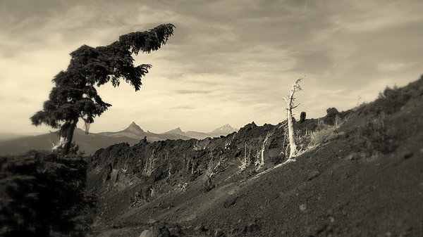
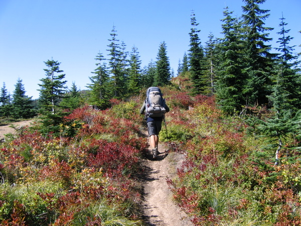
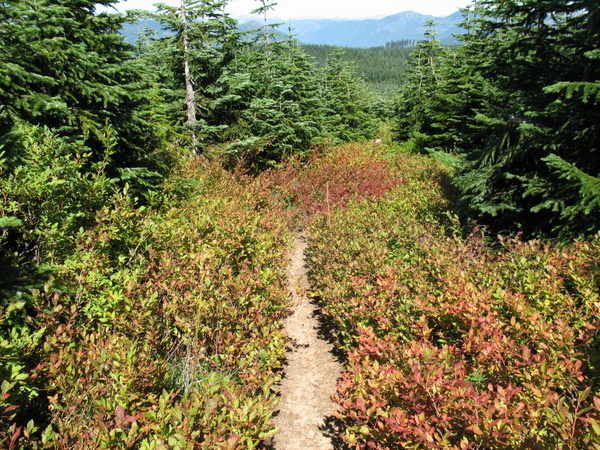
After leaving Ashland, we had some pretty kind trails to trek along. There was very little in the way of serious climbs, or rather long serious climbs. A few short n steep slogs, but nothing we couldn't handle. The best part has been the conditions of the trails. Most have been our favourite surface; compacted dirt dusted with pine needles. Of course, nothing is always going to be perfect and we have had to suffer some of the 'rocky crap' and 'soft sandy sh*t' as we have taken to calling the various less-than-ideal surfaces. This section also included the added bonus of some 'Volcanic rocky crap' too... particulalry abusive to shoe soles and skin, should you be unlucky enough to scrape against it. It does quite a wrecking job on pole tips too, so hopefully, amazing though that landscape was, with many pictures taken, it is behind us.
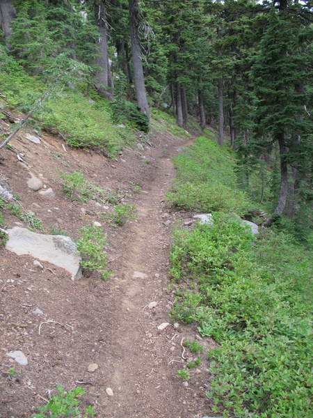
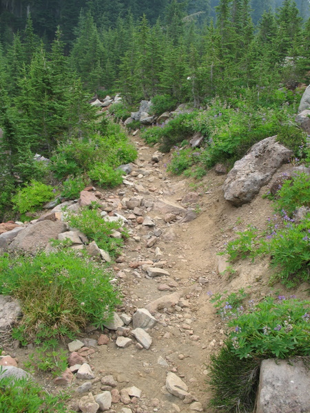
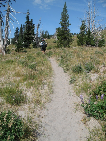
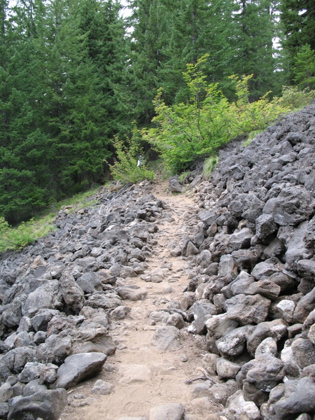
Above: our various trails... firstly, a good dirt trail, then the 'rocky crap', the calf-busting 'soft sandy sh*t and lastly, the ankle twisting, skin abrading 'volcanic rocky crap'.
The
two big highlights of the last section were Crater Lake, and the
Sisters Wilderness area. I will have quite a bit of photo stitching to
do when I get home, but for now, we still have some pretty good shots I
can post here...
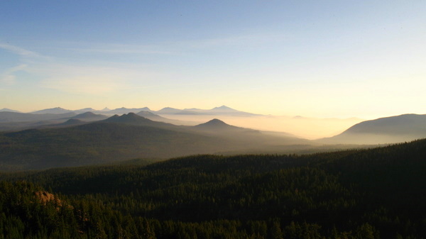
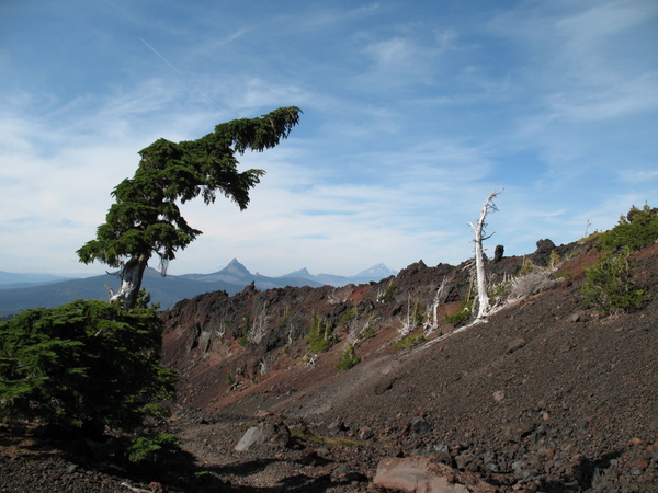
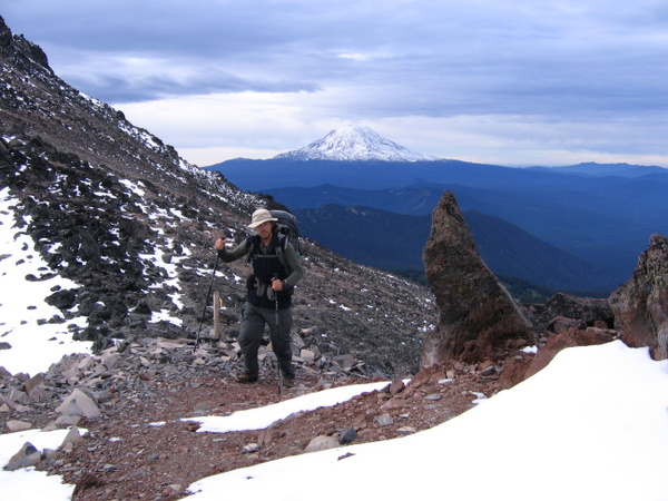
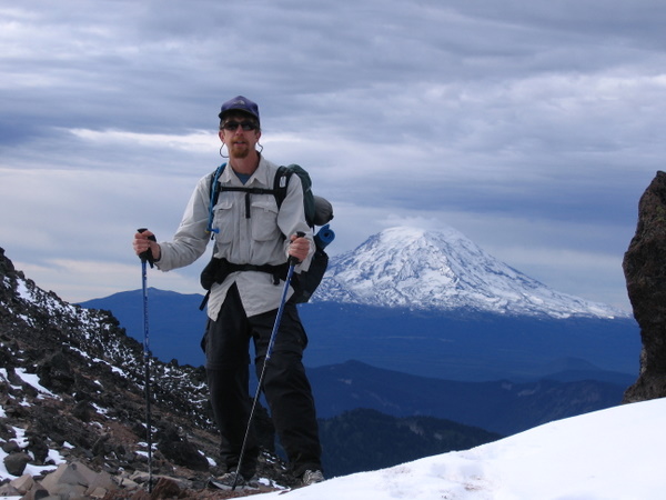
Crater Lake was mind-bogglingly huge and blue, and although it was a heck of a steep climb to get to, it was worth it. Being such a huge tourist draw, there were a ton of day trippers and day-walkers milling around, and so the chipmunks there were very used to people, and to sniffing out dropped crumbs! A week or so later, after both good trails and crunching our way along the cinders of the volcanic wasteland surrounding the 3 Sisters mountains, we reached the Dee Wright observatory point where the huge old lava flows spread out for miles around.
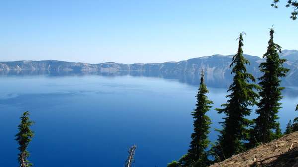
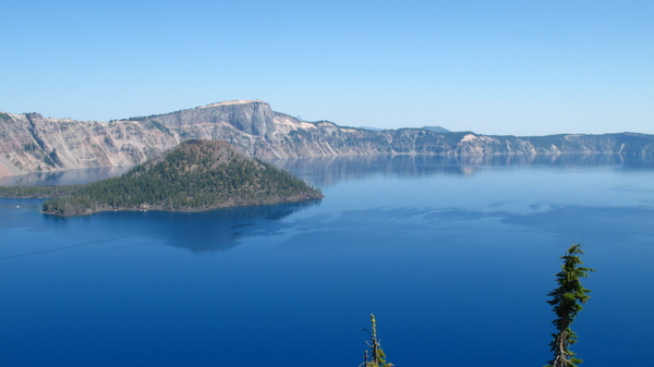
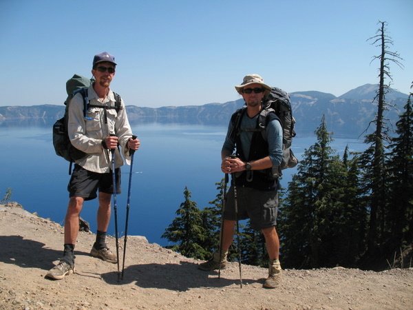
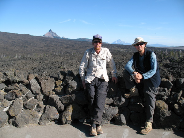
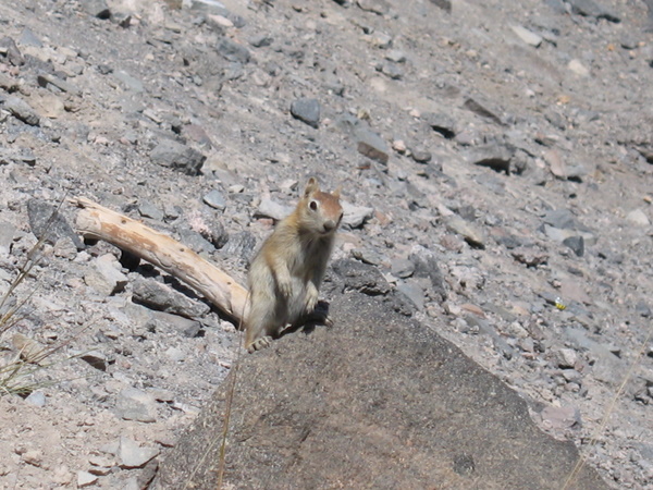
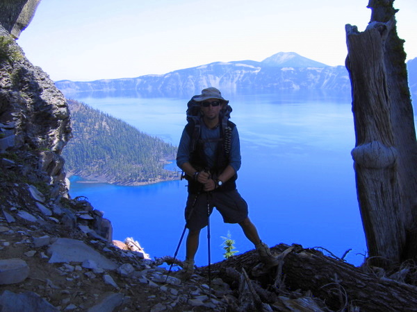
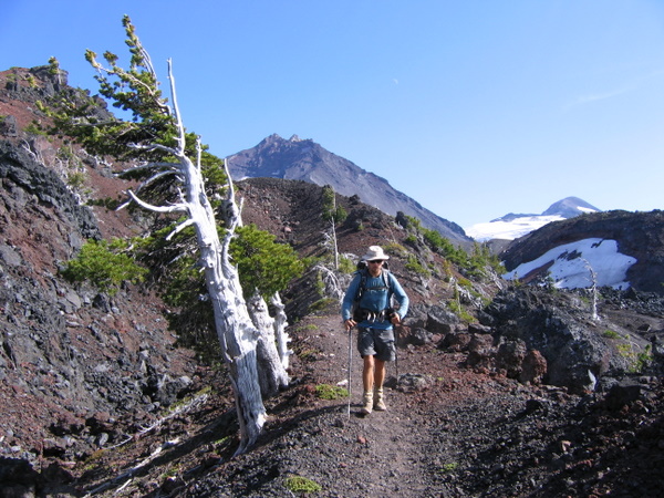
Crater Lake was mind-bogglingly huge and blue, and although it was a heck of a steep climb to get to, it was worth it. Being such a huge tourist draw, there were a ton of day trippers and day-walkers milling around, and so the chipmunks there were very used to people, and to sniffing out dropped crumbs! A week or so later, after both good trails and crunching our way along the cinders of the volcanic wasteland surrounding the 3 Sisters mountains, we reached the Dee Wright observatory point where the huge old lava flows spread out for miles around.
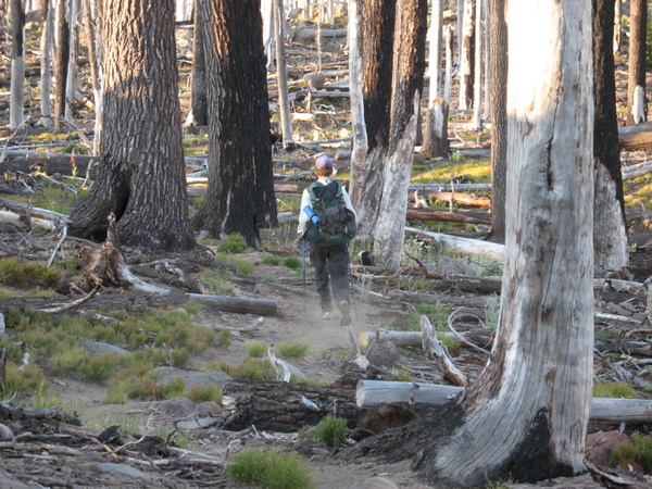
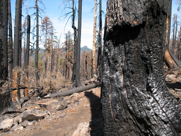
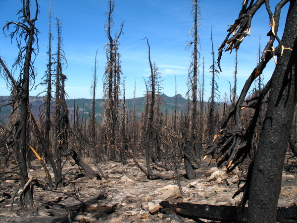
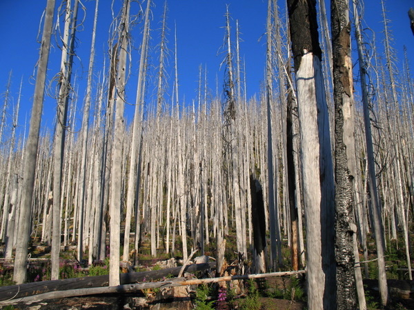
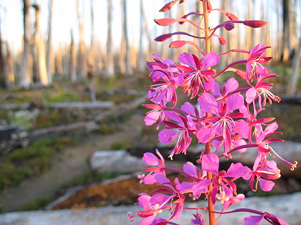
Once
we were over the lava flows, the pine forests began again, but they
took a while to become green... a huge forest fire in 2003 did a lot of
damage, but even amongst all the black ash and devastation, there were
spots of eerie beauty and even bold colour to be enjoyed... as well as
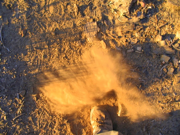
a lot of dusty trail to be pounded along, the dirt billowing out around
our feet with each step.
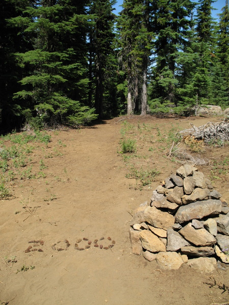
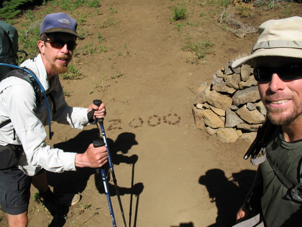
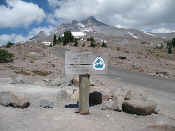
Passing
2000 miles was a pretty damn good feeling. We actually sat right at the
cairn (the rock pile) and had our lunch there, enjoying the sun, and
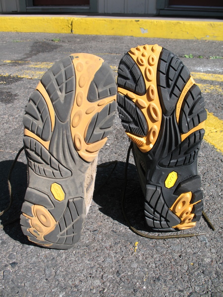
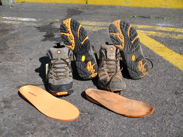
knowing we had "only" 665 miles to go. I was kitted out in my new boots
too, so the miles over the volcanic rocks were easier that morning...
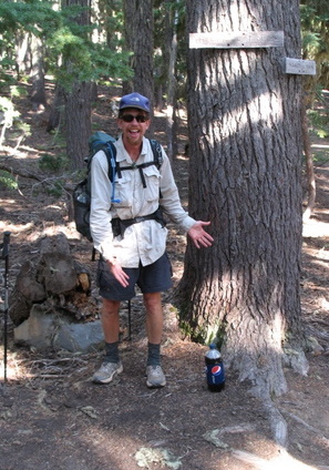
and on another day, the Pepsi we found alongside the trail that was
left for any desrving hiker ( well, the next ones who found it, most
likely... which luckily was us) made our day easier and more refreshing
too! It's Toms favourite soda, so he was understandably stoked!!
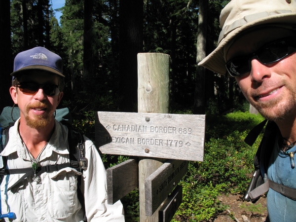
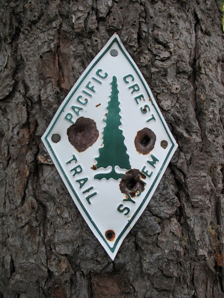
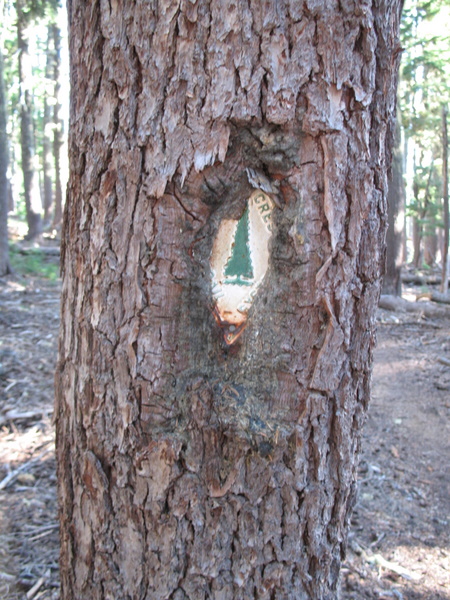
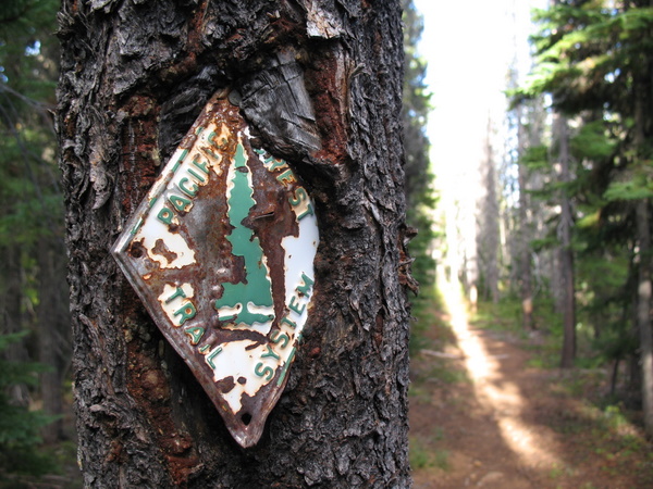
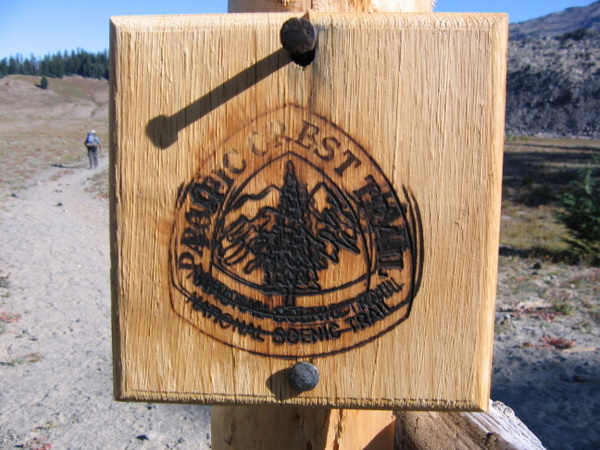
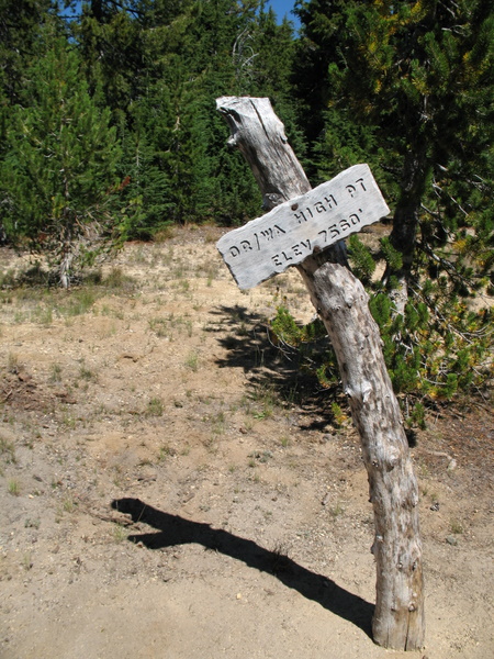
Tom
and I have both been taking quite an interest in the variety of PCT
signs, both old and new, and it was hiking through Oregon that we have
seen some very old ones. Not just old in design and wear, but also in
the way the poor tree that they were nailed to had often grown around
them like an old war-wound scarring up over shrapnel.
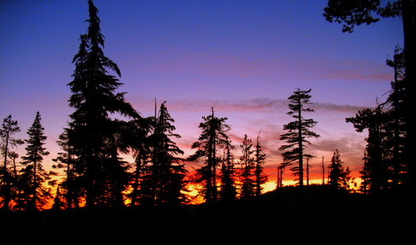
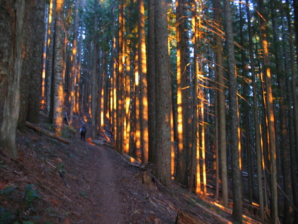
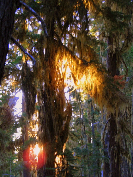
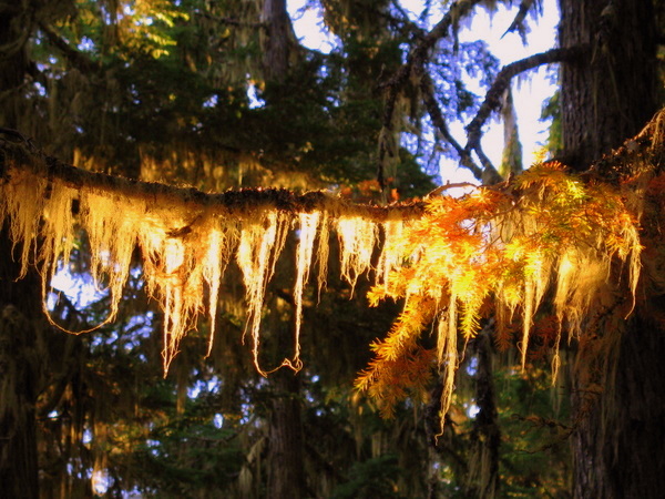
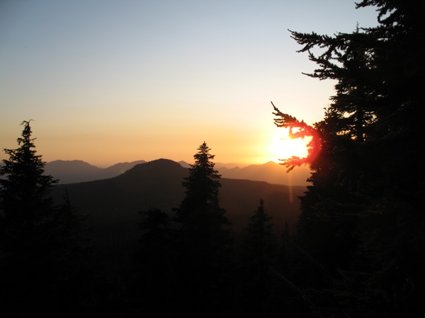
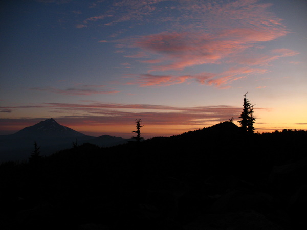
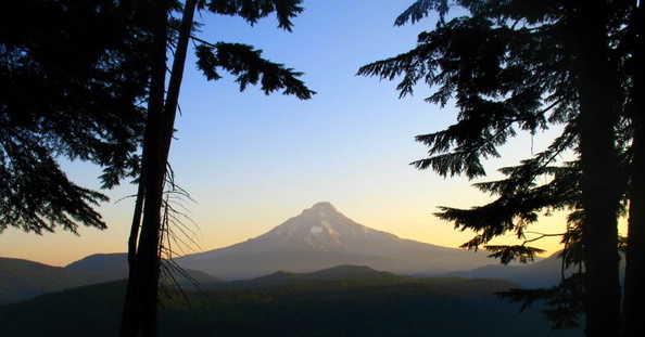
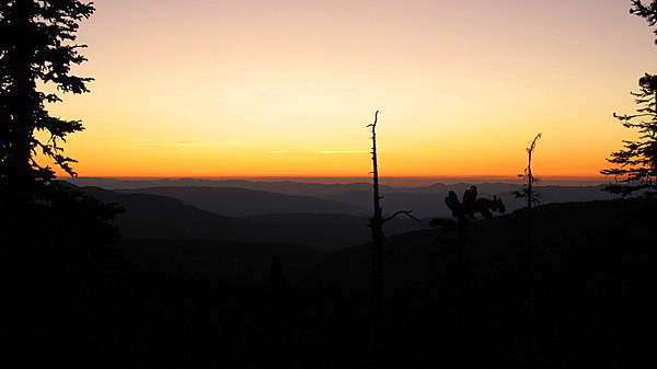
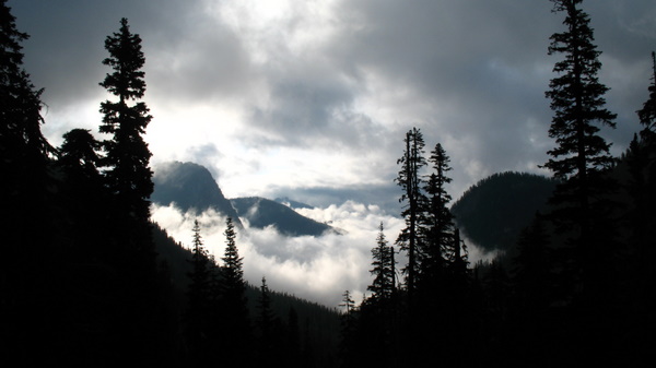
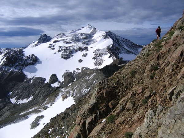
And as always, I have also enjoyed the various ways the sunlight, both rising and setting, has played across the trees, the moss and the mountains. We both agreed that the 3 Sisters were although somewhat tougher to hike around, the views of Mt Jefferson, Mt Washington, and Oregons highest, Mt Hood have been fantastic.
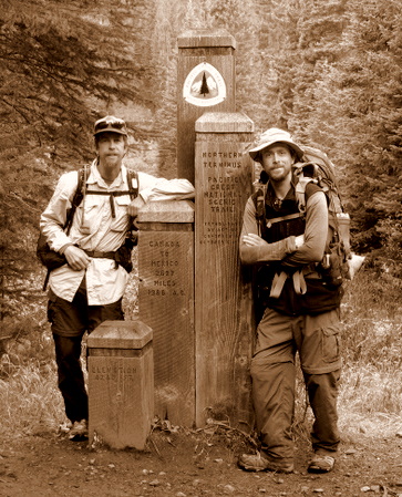
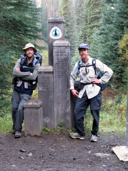
Tired but happy Roadwarriors, 0900hrs, Thursday 24th September:
PCT Northern Terminus Monument, US/Canadian Border.
And as always, I have also enjoyed the various ways the sunlight, both rising and setting, has played across the trees, the moss and the mountains. We both agreed that the 3 Sisters were although somewhat tougher to hike around, the views of Mt Jefferson, Mt Washington, and Oregons highest, Mt Hood have been fantastic.
This
will be the last update from the trail... as we only have about 3 weeks
left until we have completed the journey, we will be posting my Eee PC
back to Toms place in MN, so the final pix will get uploaded around the
25-28th of September. As always, I will try to upload 'blog' updates
via my iPhone as we go, depending on the cellular coverage of course.
So for now, I hope the above pictures were enjoyed by all... to see more, watch out for the blog updates HERE.
Cheers!
RWK.
Out.

So for now, I hope the above pictures were enjoyed by all... to see more, watch out for the blog updates HERE.
Cheers!
RWK.
Out.
Entry #10. Sunday 27th September, Columbia Heights, MN.
We're done... over 2600 miles hiked... so let the recovery begin..!
We're done... over 2600 miles hiked... so let the recovery begin..!
Tired but happy Roadwarriors, 0900hrs, Thursday 24th September:
PCT Northern Terminus Monument, US/Canadian Border.
With
great mixed feelings of relief, satisfaction and tired feet, Tom and I
have completed the gruelling, arduous, but amazing Pacific Crest
National Scenic Trail.
Over 2600 miles long, having walked from the southern terminus monument through blazing hot desert, over snow-capped peaks and passes, through thick dense pine forests and across many cold hard running creeks and rivers, we arrived at the northern terminus on Thursday morning.
We took quite a few pictures and video there, then made the last 8 mile push further north into Canada to Manning Park, where after a night at the hostel there, were given a ride back to Seattle by Stacie, Will and Christa.
After a night spent eating way too much sugary and fatty food in a motel near Tacoma airport, we arrived back in Minneapolis early this morning.
Solid big-bro Steve picked us up, and after a much needed long sleep, we caught up with Toms parents, then spent the rest of the day on the couch eating and watching football... perfect!
But to recap the past few weeks since leaving Cascade Locks...
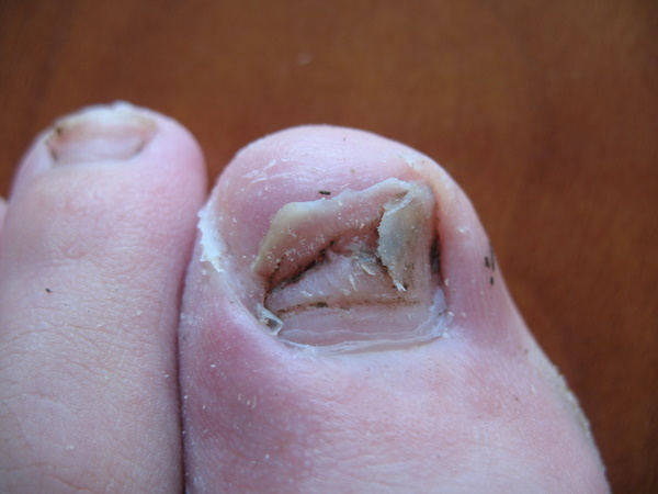
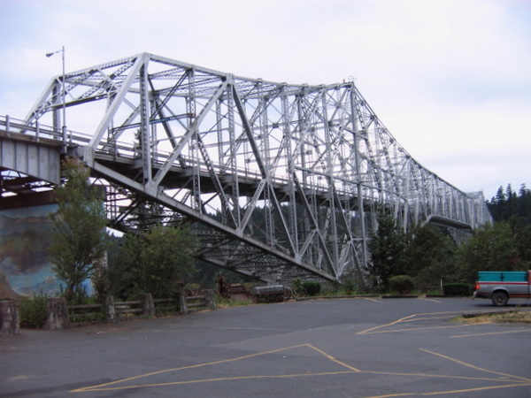
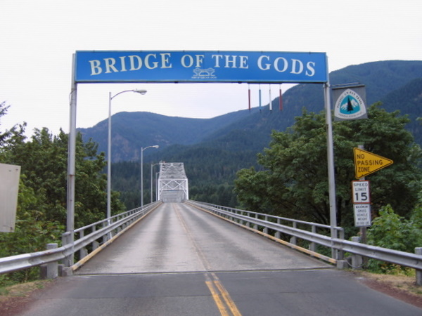
Before we left the motel in Oregon and headed over the Bridge of the Gods into Washington, I had to do something about my flapping dead black toenail... it was finally at the point where it had to be cut off before it got caught and ripped off... I snipped off what I could, as neatly as I could... It didn't hurt, but it sure looked a mess.
Once we got over the bridge, having thrown off the customary rock to splash loudly into the Columbia River, we began a steady, sometimes stiff climb back up into the mountains.
Over 2600 miles long, having walked from the southern terminus monument through blazing hot desert, over snow-capped peaks and passes, through thick dense pine forests and across many cold hard running creeks and rivers, we arrived at the northern terminus on Thursday morning.
We took quite a few pictures and video there, then made the last 8 mile push further north into Canada to Manning Park, where after a night at the hostel there, were given a ride back to Seattle by Stacie, Will and Christa.
After a night spent eating way too much sugary and fatty food in a motel near Tacoma airport, we arrived back in Minneapolis early this morning.
Solid big-bro Steve picked us up, and after a much needed long sleep, we caught up with Toms parents, then spent the rest of the day on the couch eating and watching football... perfect!
But to recap the past few weeks since leaving Cascade Locks...
Before we left the motel in Oregon and headed over the Bridge of the Gods into Washington, I had to do something about my flapping dead black toenail... it was finally at the point where it had to be cut off before it got caught and ripped off... I snipped off what I could, as neatly as I could... It didn't hurt, but it sure looked a mess.
Once we got over the bridge, having thrown off the customary rock to splash loudly into the Columbia River, we began a steady, sometimes stiff climb back up into the mountains.
The
weather was somewhat grey, but it wasn't raining and it was just right
to hike in. Unfortunately, that didn't last as we woke the next day to
rain that lasted for 3 long cold wet miserable days.
Almost no pictures were taken at all, except for a few of Mt Adams during a very brief break in the weather. We hoped the break would last... we'd been soaked and cold for 2 days when at last, the mist cleared and the sun came out giving us the great views of the dome-like Mt Adams. It was looking to turn into a nice afternoon/evening and the little sun we'd seen was quickly drying us out. It lasted less than an hour though, the mist rolling back in, the temperature dropping, and in a short space of time, rain and hail was pelting down on us again.
Luckily, although the clear night got to below freezing and my socks were covered in ice the next morning (putting on wet gear to save the only dry stuff you have to sleep in is awful!) it meant we saw the sun early, and the day turned into a glorious one.
At lunch, we laid all our stuff across the mountain side and dried it all out which was great.
Back to top.Almost no pictures were taken at all, except for a few of Mt Adams during a very brief break in the weather. We hoped the break would last... we'd been soaked and cold for 2 days when at last, the mist cleared and the sun came out giving us the great views of the dome-like Mt Adams. It was looking to turn into a nice afternoon/evening and the little sun we'd seen was quickly drying us out. It lasted less than an hour though, the mist rolling back in, the temperature dropping, and in a short space of time, rain and hail was pelting down on us again.
Luckily, although the clear night got to below freezing and my socks were covered in ice the next morning (putting on wet gear to save the only dry stuff you have to sleep in is awful!) it meant we saw the sun early, and the day turned into a glorious one.
At lunch, we laid all our stuff across the mountain side and dried it all out which was great.
Washington
was giving us distinctly harder terrain than Oregon had. A lot more
climbs and descents, unfortunately more 'rocky crap', and we also had
slightly less than perfect weather all the time. However, sometimes the
less than clear weather made for some great views also, and when it did
fully clear the scenery more than made up for the rough conditions.
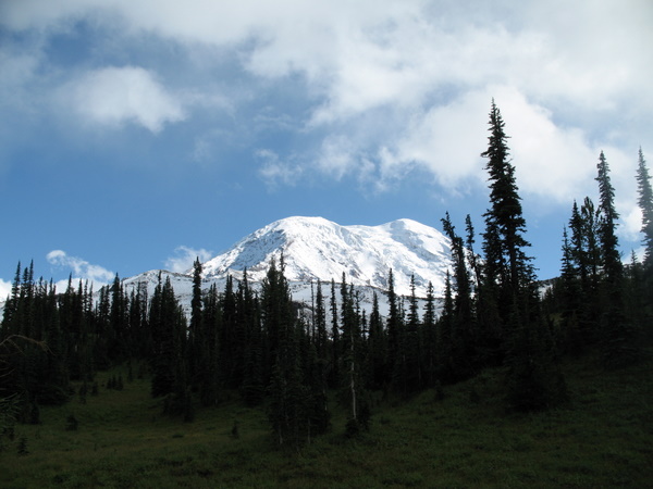
Mt Adams and Mt Rainier were very impressive, as was hiking over the tough, icy peaks at Goat Rocks. We met a great guy, Luke, who helped blaze the trail for us through the slippery ice...his big boots broke a good path for us to follow... cheers Luke... we look forward to hearing from you soon!
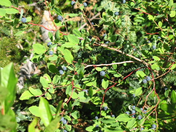
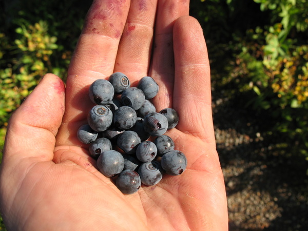
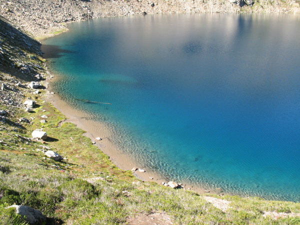
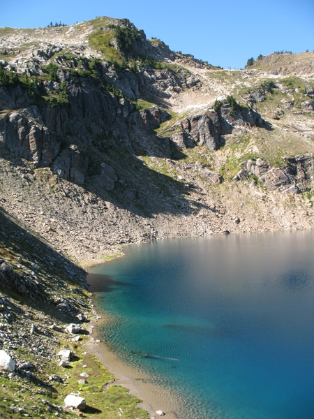
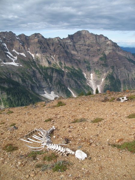
Growing wild across the mountains, the insanely abundant blueberries were a wonderful treat that I partook in as often as possible! In contrast to the slightly grim (complete with bones!) hard rocks and subdued colours of Goat Rocks, some of the lakes in the Alpine Lakes Wilderness area were the most brilliant colours of green and blue.
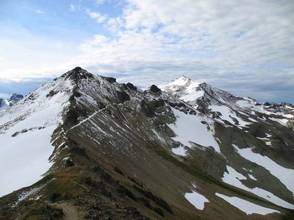
Mt Adams and Mt Rainier were very impressive, as was hiking over the tough, icy peaks at Goat Rocks. We met a great guy, Luke, who helped blaze the trail for us through the slippery ice...his big boots broke a good path for us to follow... cheers Luke... we look forward to hearing from you soon!
Growing wild across the mountains, the insanely abundant blueberries were a wonderful treat that I partook in as often as possible! In contrast to the slightly grim (complete with bones!) hard rocks and subdued colours of Goat Rocks, some of the lakes in the Alpine Lakes Wilderness area were the most brilliant colours of green and blue.
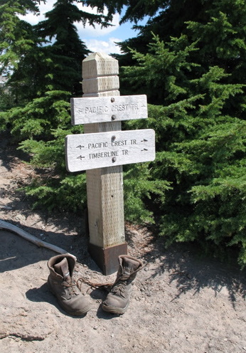
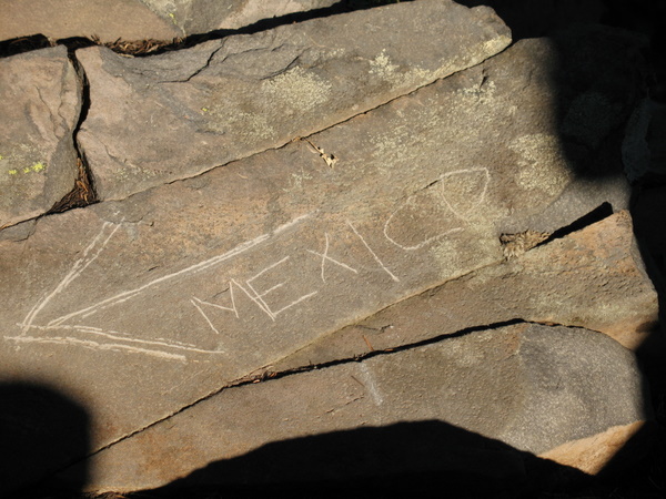
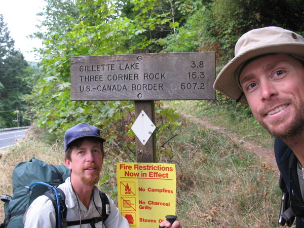
There
were many signs that we again took pictures of, especially the one at
Rainy Pass, as we'd once rested our bikes against it, 2 years and 3
months earlier... quite a fun trip down memory lane for us.
Some signs were new, some very old, but each one was a small milestone in its own right as it showed our progress, slowly making our way further north.
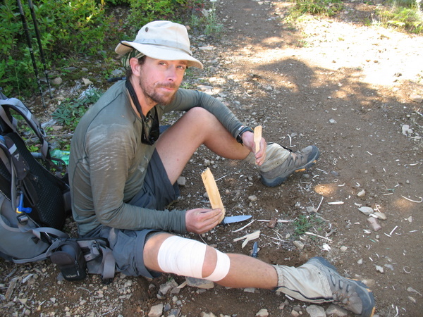
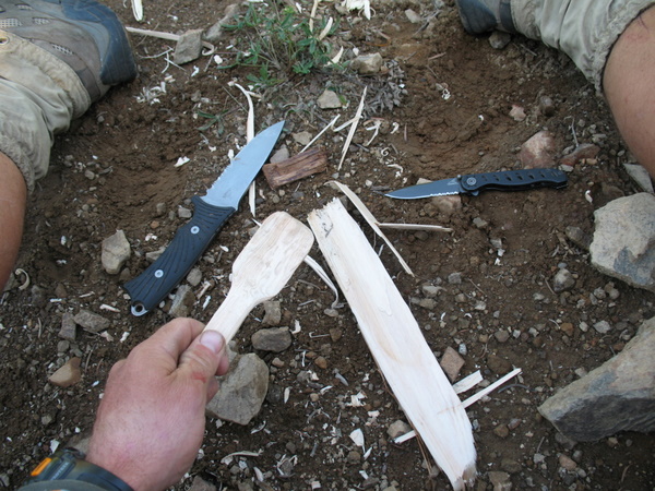
I was somewhat upset one day when I realized I'd lost my new compact travel-spoon, one I had quicky become very attached to. Having nothing to eat dinner with, I carved myself a new wooded spoon... It did the job just fine, but the next morning was replaced again, as I joyfully discovered my lost spoon... somehow I'd rolled it up in my tent the previous morning, and I found it again as we broke camp. I was pretty happy. Wooden spoon became stirring spoon, so both were getting good use!
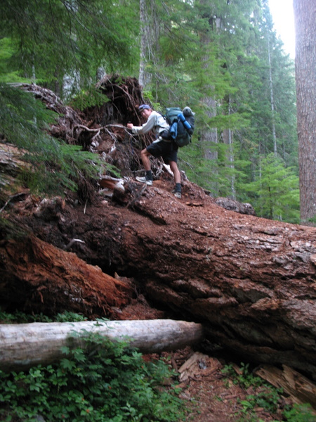
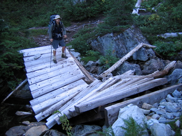
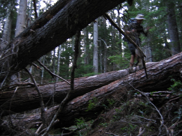
Battling through a large section of trail, about 45 miles long, (although only about 5 miles were really badly blocked) we had to contend with many fallen trees, some over 6ft in diameter, washed out or badly damaged bridges, slippery river crossings and overgrown choked paths. It was quite a challenge at times, climbing over, around, under or through some of the 'blow-downs', but a definite challenge was carefully balancing and walking up a large cottonwood tree that had fallen to become an ad-hoc bridge, crossing 50 feet across and about 6 feet over, a fast moving river.
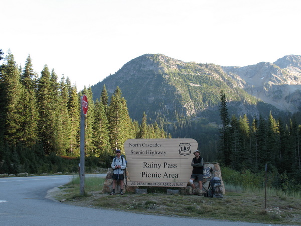
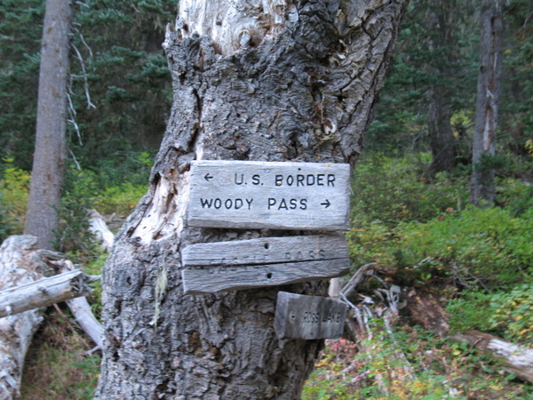
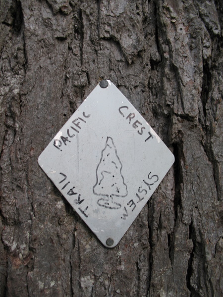
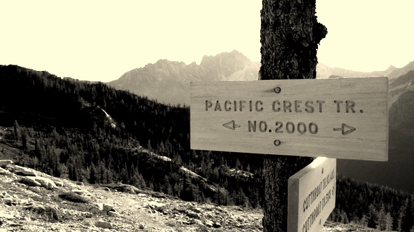
Some signs were new, some very old, but each one was a small milestone in its own right as it showed our progress, slowly making our way further north.
I was somewhat upset one day when I realized I'd lost my new compact travel-spoon, one I had quicky become very attached to. Having nothing to eat dinner with, I carved myself a new wooded spoon... It did the job just fine, but the next morning was replaced again, as I joyfully discovered my lost spoon... somehow I'd rolled it up in my tent the previous morning, and I found it again as we broke camp. I was pretty happy. Wooden spoon became stirring spoon, so both were getting good use!
Battling through a large section of trail, about 45 miles long, (although only about 5 miles were really badly blocked) we had to contend with many fallen trees, some over 6ft in diameter, washed out or badly damaged bridges, slippery river crossings and overgrown choked paths. It was quite a challenge at times, climbing over, around, under or through some of the 'blow-downs', but a definite challenge was carefully balancing and walking up a large cottonwood tree that had fallen to become an ad-hoc bridge, crossing 50 feet across and about 6 feet over, a fast moving river.
This
was by far the most gruelling but rewarding adventure we have
undertaken so far, and both of us agree that although we are glad we
did it, we won't be doing another thru hike any time soon! Biking and
kayaking are both tough, but something we prefer more... Especially the
biking. You can carry more food, plus you get to coast downhill... aah,
the sweet sweet downhill! The weight loss is less on those trips too!
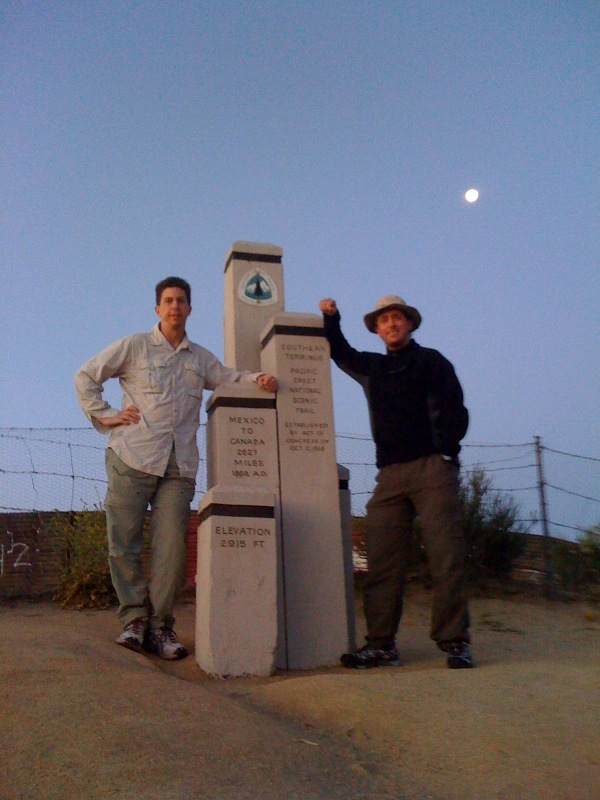
Over 2650 miles apart, the 2 monuments that mark the start and the end of a great adventure...
The next adventure is being roughed out at the moment... quite probably biking up from Singapore, through Malaysia and Thailand, then around Laos, Cambodia and Vietnam in early 2011, depending on what we are doing at that time. Hopefully we will have some new Roadwarrior Candidates to join us too... but we'll see.
So this is the end of this journal, although once I am back home I will do a final post with all the stats, as well as upload a full Flash Album... and in time, some video vignettes as well... keep checking in.
Cheers for now!
RWK.
Out.